Projects
Brunei Eritrea Earlier Projects
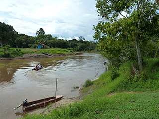 The Sultanate of Brunei lies on the North West coast of Borneo, bordered by Sarawak, one of the two Eastern states of Malaysia. The country, with a total area of 5,770km², has two enclaves separated by the valley of the Limbang River rising in Sarawak. It is divided into four districts. The climate is tropical, life expectancy averages 78 years and the literacy is at 89%.
 The Western districts of Brunei – Muara, Tutong and Belait, are dominated by hilly lowlands, swampy plains and alluvial valleys. The Eastern district of Temburong is mountainous. The cultivable area is 2.5% of the land mass. The population of 385,000, is predominantly Malay (65%) with substantial Chinese (18%) representation and is concentrated in the district of Brunei – Muara. Over 30% of the population are rural but only about 2% are engaged in agriculture. The country imports 80% of its food and exports oil and natural gas.
 The Water profile of Brunei is dominated by the use of surface water, providing over 99% of the water utilised for all purposes. There are four main river basins with the upper reaches of the Brunei River being a major fresh water source. Limited reserves of groundwater have been identified. There are two dams with total storage capacity of 45mn. m³ and a catchment area of 31km². There is no hydropower dam, although a suitable site has been located within the National Forest Reserve of Temburong.
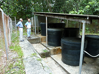
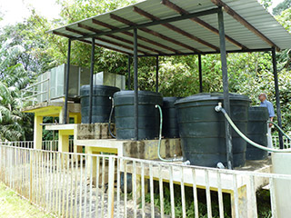
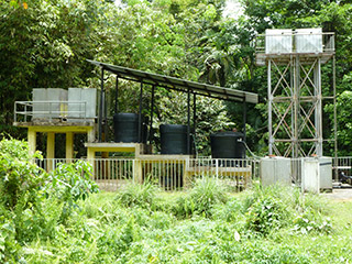 Safe potable piped system serves the community whilst a proportion of the rural community relies on the slow sand filtration Potopak system. Over the last few years, with our local partners, we have installed a number of these systems. Potapaks are now established as an important contributor to safe water supplies
Brunei long term plan (pdf)
 The Sultanate of Brunei lies on the North West coast of Borneo, bordered by Sarawak, one of the two Eastern states of Malaysia. The country, with a total area of 5,770km², has two enclaves separated by the valley of the Limbang River rising in Sarawak. It is divided into four districts. The climate is tropical, life expectancy averages 78 years and the literacy is at 89%.
 The Western districts of Brunei – Muara, Tutong and Belait, are dominated by hilly lowlands, swampy plains and alluvial valleys. The Eastern district of Temburong is mountainous. The cultivable area is 2.5% of the land mass. The population of 385,000, is predominantly Malay (65%) with substantial Chinese (18%) representation and is concentrated in the district of Brunei – Muara. Over 30% of the population are rural but only about 2% are engaged in agriculture. The country imports 80% of its food and exports oil and natural gas.
 The Water profile of Brunei is dominated by the use of surface water, providing over 99% of the water utilised for all purposes. There are four main river basins with the upper reaches of the Brunei River being a major fresh water source. Limited reserves of groundwater have been identified. There are two dams with total storage capacity of 45mn. m³ and a catchment area of 31km². There is no hydropower dam, although a suitable site has been located within the National Forest Reserve of Temburong.
 Safe potable piped system serves the community whilst a proportion of the rural community relies on the slow sand filtration Potopak system. Over the last few years, with our local partners, we have installed a number of these systems. Potapaks are now established as an important contributor to safe water supplies
